Sergio Bernardes
Geography-Geology Bldg
210 Field Street,
Room 319
Athens, Georgia
In collaboration with:
Erv Garrison (Anthropology/Geology, UGA)
Jim Wilson (English, UGA)
Cultural Heritage Preservation
Integrating UAV-Based Sensors and AI for High-Resolution Analysis of Native American Sites
Native American archaeological sites, including effigies, remain poorly understood in terms of their history, construction, and significance. Traditional methods of studying these sites, such as direct measurements and excavations, are invasive and can potentially be destructive. This project explores synergies between non-destructive remote sensing techniques to document and analyze effigies and archaeological monuments, focusing on surface and subsurface data collections.
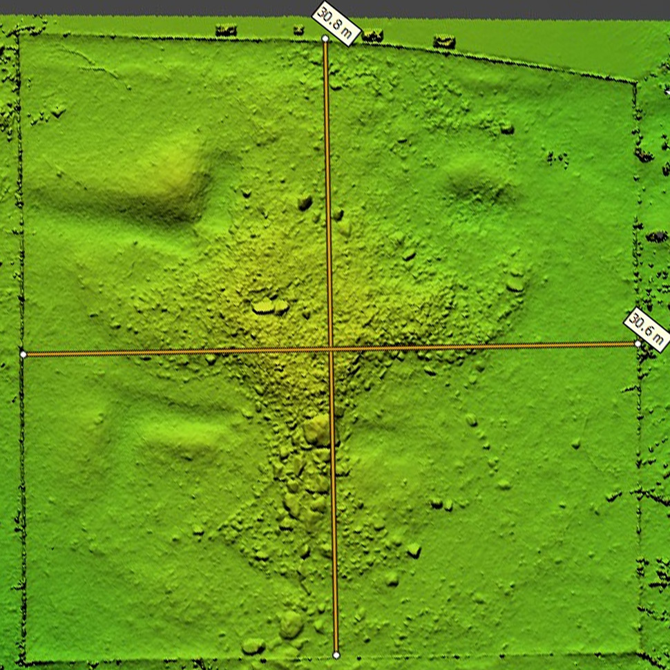
Works have used Rock Hawk and Rock Eagle effigies (Georgia, USA) as case studies and employed a UAV equipped with a high-resolution RGB camera to image the field sites. The work contributes to the characterization of sites by using AI techniques and Structure from Motion to generate detailed point clouds, meshes and surface models. The project uses theses products to detect and classify individual site components, including the extraction of metrics derived from high-resolution models that are used to digitally deconstruct and describe the sites
Funding and Collaborators:
-
Center for Teaching and Learning, UGA
-
Institute of Native American Studies, UGA
Technical Meetings:
-
Bernardes, S., Garrison, E., Wilson, J. (December 2024). Integrating UAV-Based Sensors and AI for High-Resolution Analysis of Two Native American Effigies. Fall Meeting of the American Geophysical Union. (upcoming).