Health Science
Geospatial Contributions to Worldwide Elimination of River Blindness (Onchocerciasis)
Using Earth Observations to Locate at-Risk Yanomami Populations and Airstrips in the Amazon Region

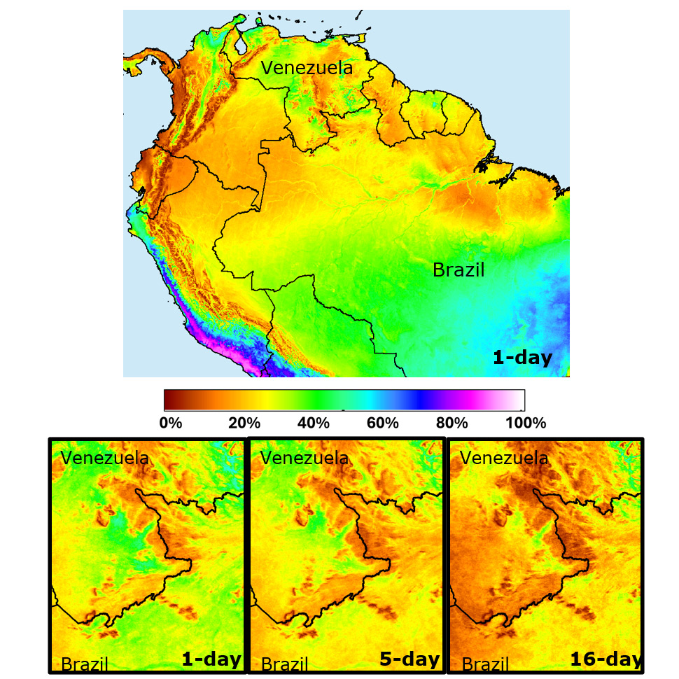
Previous efforts to identify Yanomami villages and airstrips near the border between Brazil and Venezuela have faced multiple data/methodological limitations, as reported by The Carter Center to The Onchocerciasis Elimination Program for the Americas (OEPA). The lack of wall-to-wall coverage by recently acquired very high resolution imagery; the high cloud cover characteristic of the region, and the lack of resolving power of traditionally used Landsat satellite images imposed limitations to the identification of those villages and airstrips. Effective identification of forest clearings characteristic of villages occupied by Yanomami and the location of airstrips with potential to be used when assisting those populations are critical to the success of The Carter Center’s River Blindness Elimination Program.
This project benefited from our 25 years of experience in vegetation characterization and monitoring in the Amazon and addressed those data and methodological limitations. The provided technological solution used images acquired by two satellites of the Sentinel series, launched by the European Space Agency (ESA). Sentinel optical images cover the entire Yanomami region at improved spatial resolution, when compared to images acquired by Landsat satellites.

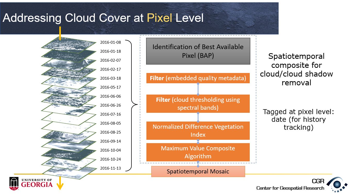
Proposed geospatial technologies addressed feature obstruction by cloud cover by using time series of Sentinel-2 images and by creating cloud-free time composites. In addition, the project takes advantage of the availability of radar images acquired by the Sentinel-1 satellite to identify changes in vegetation cover caused by human populations. Sentinel-1 images have the ability to see through clouds and can detect changes in forest cover.
Funding and Collaborators:
-
The Carter Center
Program website: River Blindness Elimination Program
Technical Meetings:
-
Bernardes, S. (March, 2017) OEPA: UGA Mapping in the Siapa Valley. 21st Annual River Blindness Elimination Program Review. The Carter Center. Atlanta. Georgia. (invited).
-
Bernardes, S., Knight, A. & Madden, M. (December, 2016). Geospatial contributions to worldwide elimination of river blindness (onchocerciasis): Using earth observations to locate at-risk Yanomami populations and airstrips in the Amazon region. Project report presented at the 2016 InterAmerican Conference on Onchocerciasis. Guatemala City. Guatemala. Invited by The Carter Center.
