Coastal Wetlands
Spatiotemporal Patterns of Wrack Disturbance in Salt Marshes: Implications for Ecosystem Properties

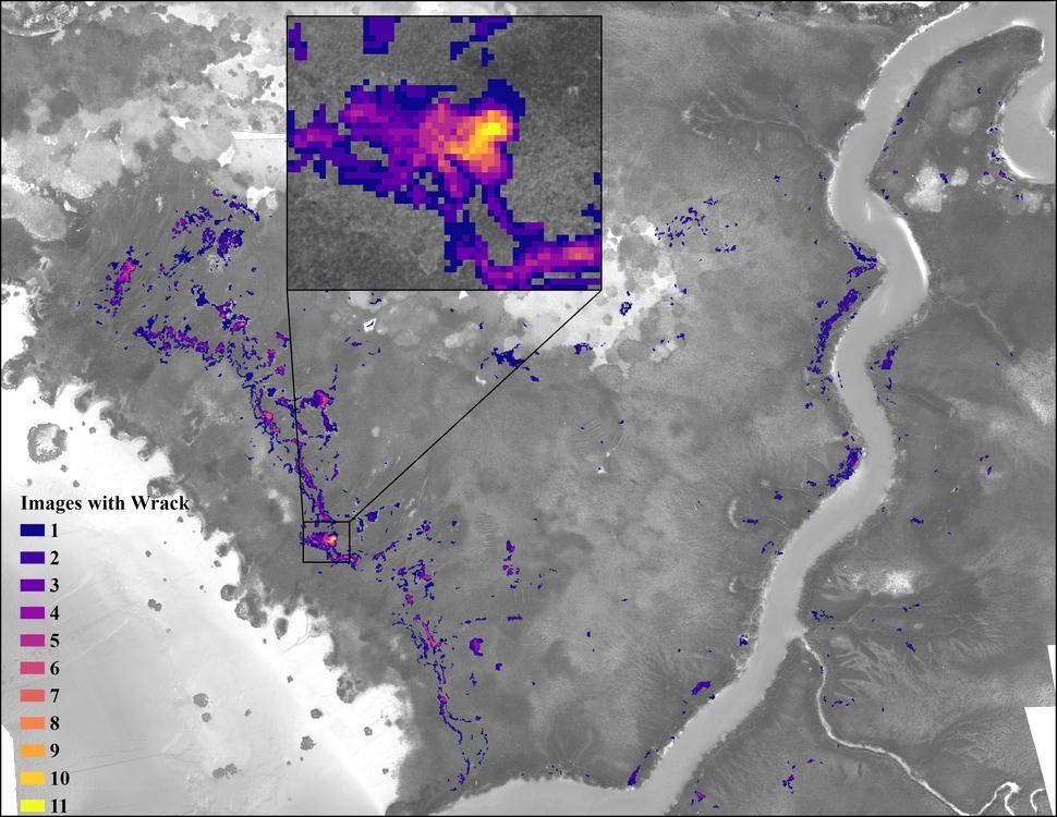
Our research uses remote sensing techniques to evaluate the spatiotemporal patterns of wrack (dead plant material) in salt marshes along the Georgia Coast. Unmanned aerial vehicles are used to collect imagery that are used to identify patterns of wrack accumulation. We then use these data to evaluate the effects that wrack has on the biophysical properties of wrack disturbed areas.
Upcoming research includes evaluating how various wrack properties affect the recovery trajectory of disturbed patches, scaling up local observations using satellite imagery to compare spatiotemporal patterns of wrack distribution across various scales, and assessing whether large wrack events make measurable impacts on gross primary productivity.
Publications:
-
Lynn, T., Alber, M., Shalack, J. and Mishra, D. 2023. Utilizing Repeat UAV Imagery to Evaluate the Spatiotemporal Patterns and Environmental Drivers of Wrack in a Coastal Georgia Salt Marsh. Estuaries and Coasts. https://doi.org/10.1007/s12237-023-01265-z
Funding and Collaborators:
-
NSF (Georgia Coastal Ecosystems LTER OCE1237140 and OCE1832178)
-
UGA Marine Institute
